Introduction: Severe Winter System Prompts Heightened Warnings Across Eastern Canada
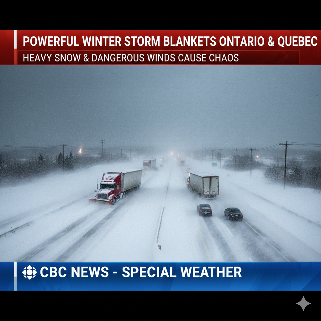
Residents across large portions of Ontario and Quebec are preparing for a significant winter storm that meteorologists warn could deliver intense snowfall, powerful winds, and hazardous travel conditions over the coming days. Environment and Climate Change Canada (ECCC) has issued a series of winter storm warnings and special weather statements as the system moves eastward, bringing the potential for widespread disruptions, school closures, and dangerous driving conditions.
The storm is expected to affect both northern and southern regions, with snowfall projections ranging from 10 centimetres in some areas to as much as 60 centimetres in the hardest-hit zones. Officials are urging the public to take precautions, limit unnecessary travel, and remain alert as conditions deteriorate from Wednesday into Thursday and potentially beyond.
Northern Ontario Faces the Brunt of the Storm
Winter Storm Warning in Effect for Multiple Regions
In northern Ontario, Environment Canada has issued a winter storm warning as the system intensifies. Some communities could see accumulations of up to 60 centimetres of snow, accompanied by reduced visibility and rapidly deteriorating road conditions.
Preparedness meteorologist Gerald Cheng noted during a Wednesday afternoon briefing that the storm was already causing disruptions even before reaching full intensity.
He explained that snowfall had begun falling across several northern areas, with certain transportation routes already closed as conditions worsened. The combination of heavy, wet snow and strong winds has created treacherous travel conditions for motorists, particularly on rural and remote highways.
Highway Closures and School Disruptions
The Ontario Provincial Police (OPP) confirmed multiple road closures in northern parts of the province, reflecting the severity of the storm. Sections of Highway 144 near Timmins, Highway 11 near Hearst, and parts of Highway 631 between White River and north of Hornepayne were among the routes temporarily shut down due to unsafe driving conditions.
In the Thunder Bay region, schools in rural areas were forced to close, and bus services were cancelled as visibility on the roads dropped sharply. Wet, heavy snow combined with gusting winds made travel especially challenging for both residents and emergency services.
Environment Canada warned that snowfall rates could peak at up to four centimetres per hour, significantly increasing the risk of whiteout conditions and making visibility nearly impossible in some locations.
Strong Winds Intensify the Threat
Gusts up to 70 km/h in Northern Zones
Alongside the heavy snowfall, strong northerly winds gusting up to 70 km/h are forecast across northern Ontario. These winds are expected to blow loose snow across highways and open areas, creating dangerous drifts and further reducing visibility.
Weather officials stressed that travel will likely become hazardous, with possible road closures as conditions evolve. Motorists are being advised to avoid unnecessary travel and to monitor local updates closely if travel cannot be postponed.
Storm System Extends Into Quebec
Warnings and Special Statements Issued
The winter storm is not confined to Ontario, as it continues its path into Quebec. The official winter storm warning stretches eastward into regions around Lake Mistassini, with areas beyond the main warning zone placed under special weather statements.
Communities such as Manic, Baie-Trinité, Sept-Îles–Port-Cartier, and Labrieville are being warned of moderate snowfall beginning Wednesday night and continuing into Thursday evening, with accumulations reaching up to 15 centimetres in some areas.
Residents are advised to remain cautious and limit travel where possible, especially during periods of peak snowfall and high winds.
New Colour-Coded Weather Alert System Explained
A Modernized Approach to Weather Warnings
During the same briefing, Environment and Climate Change Canada unveiled a revamped colour-coded alert system designed to help the public better understand the severity of weather threats. The updated system categorizes alerts based on the level of risk and potential impact:
- Yellow Alerts indicate moderate, localized, or short-term weather impacts.
- Orange Alerts highlight major and widespread weather conditions that may persist for several days.
- Red Alerts are reserved for severe, prolonged, and wide-reaching events that pose significant risks to life and property.
The new system will ensure that website and app banners reflect the alert colour clearly, making it easier for the public to recognize the seriousness of incoming weather events at a glance. Priority notifications will be sent through the WeatherCAN app if conditions escalate to the highest risk level.
This shift is aimed at improving public response times and encouraging early preparation, especially during extreme winter weather conditions.
Southern Ontario Also Under Threat
Snow and High Winds Expected from Windsor to Kingston
While northern Ontario faces the heaviest snowfall, southern Ontario is also expected to experience challenging conditions. The storm system is forecast to bring snow and powerful winds across the region stretching from Windsor through the Greater Toronto Area and eastward toward Kingston.
Cheng warned that the southern portion of the province is likely to experience gusts up to 90 km/h, particularly along the shores of Lake Erie and the northeastern shores of Lake Ontario. These strong winds are expected to generate significant lake-effect snow, further adding to accumulation totals.
Snow Squall Watch Issued
A snow squall watch has been placed over several counties, including Huron, Grey, Bruce, Simcoe, Wellington, and the Waterloo Region. These areas could see snowfall totals ranging from 30 centimetres to potentially 50 centimetres for locations closer to Lake Huron.
Snow squalls are expected to develop overnight Wednesday into Thursday and may persist into Friday. Officials caution that these squalls can shift rapidly before locking into place later in the week, resulting in sudden and intense bursts of snowfall.
Wind Warnings and Utility Concerns
Potential Power Outages and Property Damage
Special weather statements have been issued for much of southern Ontario, including Toronto and surrounding areas, warning of extremely strong winds that could reach up to 90 km/h. These winds present risks to utility infrastructure, with the potential for localized power outages.
Authorities have cautioned that high-sided vehicles may be difficult to control and that loose outdoor objects such as signs, bins, and holiday decorations could become airborne hazards.
Wind warnings are also in effect for Norfolk and Haldimand counties, the Niagara region, and areas near Lake on the Mountain Provincial Park. Although winds are forecast to weaken gradually by Thursday morning, they are expected to remain strong enough to pose ongoing safety concerns.
Travel Disruptions Likely Across Provinces
Authorities Urge Caution and Preparedness
Environment Canada and emergency services are emphasizing the importance of planning ahead and staying informed before venturing outside. Meteorologist Steven Flisfeder advised the public to take additional precautions and adjust travel plans as necessary.
Drivers are being encouraged to maintain safe following distances, reduce speed, and allow extra time for commutes. Poor visibility caused by blowing snow could significantly slow travel and increase the risk of collisions, especially during peak snowfall periods.
Residents are also advised to equip their vehicles with winter emergency kits, monitor road closure updates, and check local forecasts frequently.
Community Response and Preparedness Measures
Residents Brace for Impact
Across Ontario and Quebec, residents are stocking up on essentials, securing outdoor items, and inspecting heating systems in anticipation of prolonged winter conditions. Municipal services are preparing snow-clearing equipment and staffing emergency response teams to manage the surge in weather-related calls.
Public transit operations may also experience delays or disruptions depending on snowfall intensity and road safety concerns, particularly in heavily affected areas.
Conclusion: Heightened Vigilance as Storm Intensifies
The approaching winter storm stands as a reminder of the powerful and unpredictable nature of Canada’s winter season. With heavy snow, strong winds, and reduced visibility expected across large parts of Ontario and Quebec, authorities continue to stress the importance of vigilance and early preparation.
Through the introduction of a new colour-coded alert system and ongoing real-time updates, Environment and Climate Change Canada aims to ensure that residents receive clear, actionable information. As the storm unfolds, cooperation between emergency services and the public will be critical in minimizing risks and ensuring safety.
For now, residents are urged to stay informed, follow official guidance, and prioritize safety as this p